Today I surveyed 3 peaks and I just noticed my GPS tool shows an absolute height and another above sea level. The wiki says to use ASL, but I wonder is has to be that that is reported as such (it's the first time I see boy0th, and maybe this has lead to other discrepancies between what the GPS was telling me what #OpenStreetMap already had. OTOH, ~50m of difference sounds like a lot?
@mdione I’m not sure, but I’m guessing OSM projects lat/long on the WGS84 datum.
@alan @daniel right, but now I find myself with 3 very stable ASL elevation measurements that differ from #OpenStreetMap and I don't know what to do :(
@mdione @alan @daniel this is an old problem (and because the offset is known fairly easy to detect), but it for example why we removed elevation from the GPX tracks generated with the standard Android Location API here https://vespucci.io/help/en/15.0.0%20Release%20notes/#support-for-barometric-sensor-and-improved-elevation-support-experimental
@mdione @alan @daniel no you should be able to use the Android NMEA API and on devices from Android 14 onwards https://developer.android.com/reference/android/location/Location#getMslAltitudeMeters() either needs to be supported by the app naturally. Using barometer height improves accuracy but requires calibration so doesn't really solve the issue.

@daniel @mdione
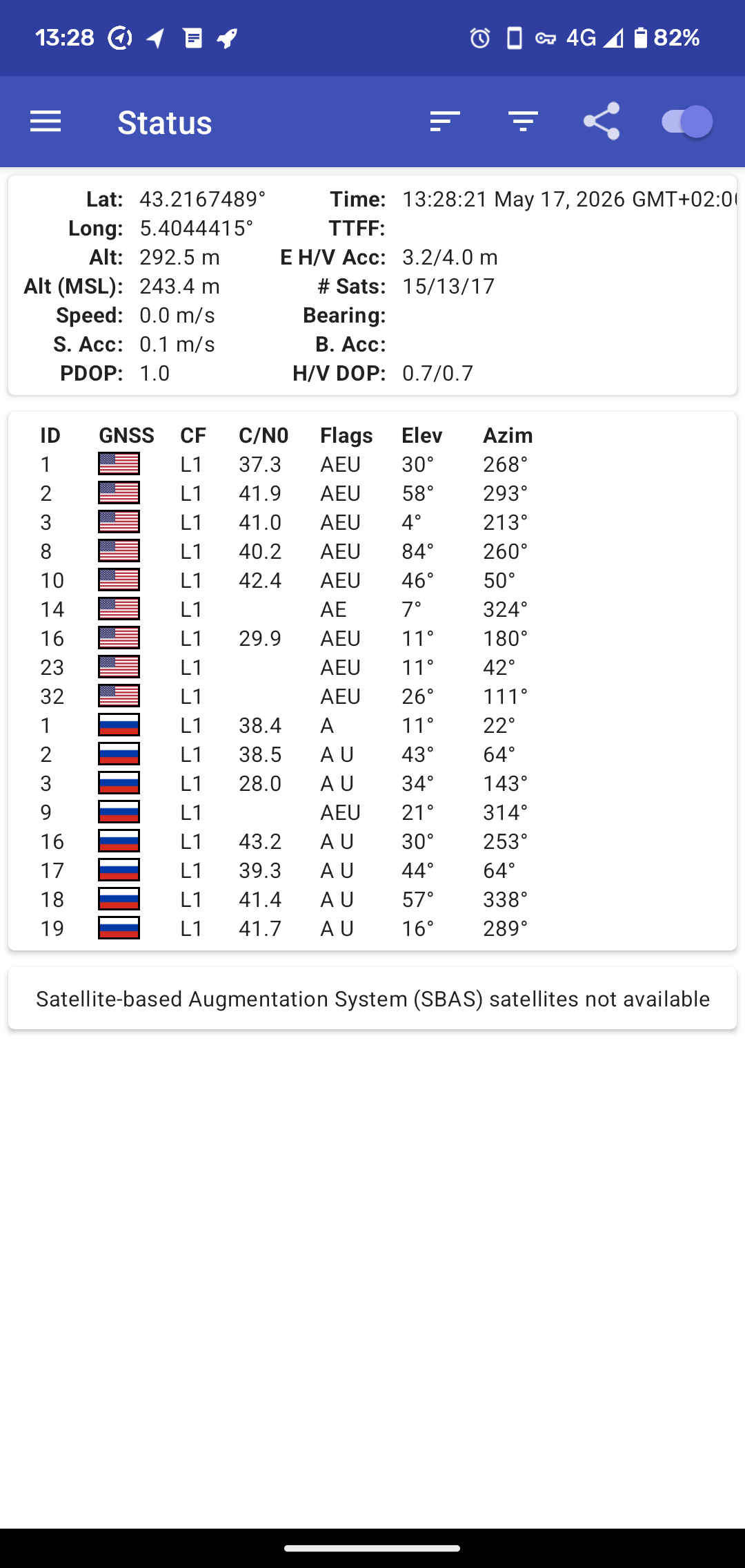
My own phone routinely shows an even bigger difference. It slightly bothers me that OsmAnd shows me at 70m when I am standing beside the sea, where a GPS status app on the same phone shows Alt (MSL) close to 0m.
I'd guess that in practice many "ele" tags in OSM are "the number written on some kind of inscription at the top of the mountain" or "the number displayed on a map produced by some national mapping body" - likely closer to ASL generally.